County Pockets Annexation
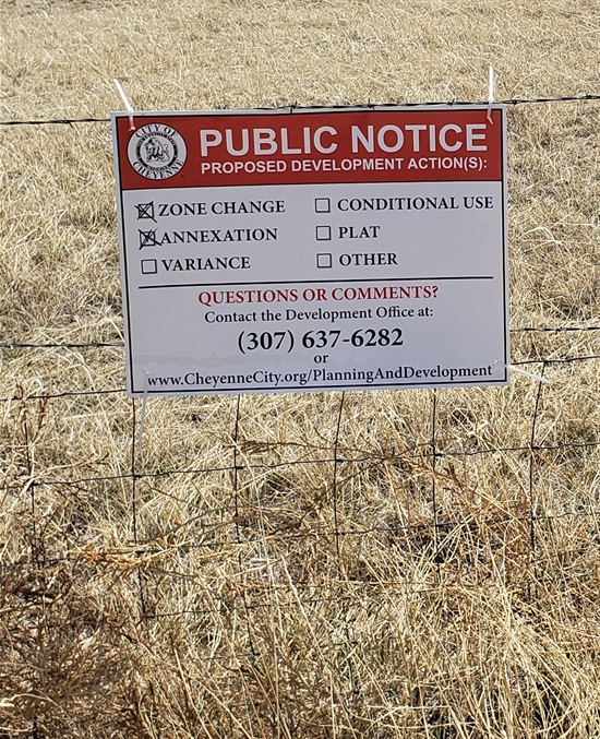
Within the boundaries of the City exist numerous County pockets. County pockets are unincorporated areas of land surrounded by the City that are typically not served by City services and have been developed in accordance with County rules and regulations. The City Council identified the annexation of County pockets as a 2022 priority which began this process. The City intends to initiate annexation of pockets 100% surrounded by the City pursuant to Wyo. Stat. § 15-1-404 in phases. Annexing properties will also require establishment of a City zone district.
County pockets 100% surrounded by the City can be found online at this interactive map:
County Pockets Map
Since these annexation actions are City-initiated, property owners will not be responsible for fees or costs that are typically associated with annexation and zoning. This represents a financial savings for property owners annexed ($5,000 - $10,000 typical cost for mapping and surveying and $1,425 in City application fees).
County pockets are not served by Cheyenne Fire Rescue or the Cheyenne Police Department and depend on a Fire District and Sheriff Deputy response for emergency which oftentimes result in a delayed response. Typically, water and sewer service are not provided, however in certain cases users have entered into an outside user’s agreement for service which mandates an increased rate (150% of the in-City cost). Upon annexation, rates for users presently subject to an outside user’s agreement will default to City-standard rates.
At the time of annexation, the City will not require upgrade to any individual properties or structures, installation of any public utilities, connection to City services, or upgrades to adjacent streets. Public improvements will only be required upon a development action, such as subdivision of a property, construction of new multifamily or non-residential development, or a change of use of the property. Permits for remodeling or additions to existing structures, that retain their existing use, or connections to water and sewer systems, will not trigger full public improvements.
County Pocket Annexation Update:
The City is presently mapping County pockets five, six, seven and eight which generally located in north and east Cheyenne.
Proposed Zoning:
Property zoning will utilize the City's assigned zoning policy for guidance. That policy establishes the City zone district that is most similar to the County zone district for the property. A full list of analogous districts is online here: Assigned Zoning.
Properties annexed will have City zoning established as follows:
- County AR (Agricultural Residential will be zoned AR (Agricultural Residential)
- County LR (Low Density Residential) will be zoned to City LR (Low Density Residential)
- County MR (Medium Density Residential) will be zoned City MR (Medium Density Residential)
- County HR (High Density Residential) will be zoned City HR (High Density Residential)
- County PUD will be zoned City CB (Community Business)
To find zoning the zoning of your property utilize the County Assessor's Map which is accessible here: County Assessor Map

How to Attend Meetings:
Information on how to join a meeting of the Governing Body or a City Council committee meeting virtually is online here no less than the Friday prior to the meeting: https://www.cheyennecity.org/ecm.
Information on how to attend a Planning Commission virtually will be on the agenda approximately one week prior to the meeting and is available here: https://cheyennecity.org/PC.
Assessment Estimator
For information on changes to property tax, please utilize the Laramie County Assessor's property tax calculator which is available online at the following link: Property Tax Calculator
Tax districts for County Pockets will generally change from tax district 0117 to 0150 (67.21 mills to 70.71). Please use these tax districts when utilizing the Laramie County Property Tax Calculator.
Utilities and Public Improvements
Upon annexation, properties will be have police and fire response, pay City-water and sewer rates if connected, and be eligible for sewer and water service connections. Tap and system development fees are not waived as part of the annexation and any active reimbursement agreements will still apply. Ordinances have recently been revised to clarify that a connection to water or sewer will not trigger public improvements such as construction of street, curb, gutter, and sidewalk. In certain cases, main extensions may be required to provide sewer or water service. Connections to City services must be installed to Board of Public Utility standards.
In the event an existing septic system fails or needs replacement and connection is not feasible, an exception process exists to allow septic system replacement if a hardship exists.
Public improvements such as road construction, will only be required upon action by the property owner. Public improvements will be required upon subdivision or change of use. Road construction will not be required for sewer or water connections.
Connection costs (2025 Rate):
Below are rates for water and sewer for a 3/4" tap which is typical for single-family residences. If you require a larger connection size, please visit the BOPU Water and Sewer Rate website. The person connecting will also be responsible for any costs associated with the connections on their property. Connection type is at the discretion of BOPU and availability of nearby utility lines.
- Water and Sewer rate: $14,860 ($14,327 connection fee + $533 tap fee)
- Water only - $11,664 ($11,298 connection fee + $366 tap fee)
- Sewer only - $3,196 ($3.029 connection fee + $167 tap fee)
Solid Waste Collection Requirements
Upon approval a County Pockets annexation, City solid waste service will be required. Sanitation-only service costs $31.84 monthly. If your property is in the process of being annexed, contact the Sanitation Division to set up a sanitation-only account. They can be reached at 307-637-6440 Monday - Friday: 8:00 a.m. to 5:00 p.m. Additional information is on their website at: https://www.cheyennecity.org/Sanitation.
Land Use Expectations
Upon annexation, lands will typically be zoned in accordance with PlanCheyenne which is the City and County's joint Land Use Plan. The existing use of the property, including any livestock use, will be allowed to continue as is as a nonconforming use. Nonconforming uses may continue until they are abandoned for a period of 12-months.
Residents are encouraged to complete the following form detailing the existing use of the land for documentation purposes. Documentation of existing conditions can be provided in a variety of ways. Written narratives supported by site photos, business licenses, tax statements, leases, and relevant information are encouraged. This form can be found below:
Land Use Documentation Form
Voluntary Annexation Form
Residents wishing to be annexed by the City in the early stages of this project may complete the Voluntary City-initiated Annexation form. City staff will contact you prior to annexation regarding proposed zoning and the need for surveying or collection of additional information. The form can be found below:
Voluntary City-initiated Annexation Form
June 24th City Council Work Session
On June 24, 2022, the City Council held a work session on this topic. The PowerPoint Presentation is available here: Presentation (PDF, 2MB)
The Work Session video is available here:
Useful Links
PlanCheyenne:
Community Plan (2014):
This element of the plan was adopted in 2014 and addresses the community’s basic form and land-use patterns. The plan can be accessed here: Community Plan
Parks and Recreation Master Plan (2006):
This element of the plan was adopted in 2006 and addresses the community’s parks and recreation needs. The plan is available at the following link: Parks and Recreation Master Plan
Long Range Transportation Plan (2020):
This element of the plan was adopted in 2020 and addresses the community’s current and future transportation needs. The plan is available at the following link: Connect 2045(PDF, 112MB)
Future Land Use Plan and Transportation Plan Map (2020):
This element of the plan was adopted in 2020 and represents a regional Future Land Use and Transportation Plan. The plan is available by clicking here: Future Land Use Plan(PDF, 2MB)
For information Zoning: Cheyenne General Information Map
For information on property taxes, visit the County Assessor's page here: County Assessor's Page
For information regarding Property Tax, including Mill Levies, visit the County Treasurer's general information page here: County Treasurer's General Information Page