Join us in Celebrating 30 Years of the Greater Cheyenne Greenway
Published on March 29, 2021
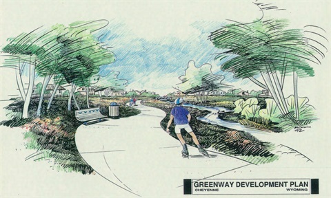
CHEYENNE – Join us in celebrating the 30th Anniversary of the Greater Cheyenne Greenway! Since voter approval on the 6th Penny Sales Tax ballot in 1991, the Greater Cheyenne Greenway has grown to encompass over 44 miles of safe, separated non-motorized paths in the Capital City. The 10-foot-wide concrete paths provide connectivity throughout Cheyenne for recreation, transportation, and relaxation.
As we celebrate the 30th Anniversary, we want to hear from you! We encourage the public to submit Greenway pictures, videos, and stories on social media using the hashtag #Greenway30. You can also send pictures, videos, and stories using our online form: https://bit.ly/3rsJp9K. Submitted items may be publicized by the City on their website, social media, or other print material.
As the winter thaw fades to spring and summer, the Greenway is a perfect way to explore Cheyenne. The path snakes along Crow and Dry Creek, parks, schools, neighborhoods, and commercial centers. It stretches from Four Mile Road at the Pointe subdivision to the north, Laramie County Community College (LCCC) to the south, Interstate 25 to the west, and the expanding Saddle Ridge subdivision to the east.
Prior to the 1991 ballot measure, the Greenway we know today originated with the formation of the Crow Creek Greenway Committee. The grass roots group was formed on Earth Day 1990 comprised of citizens interested in cleaning-up the environment and building a path along the creek. The Crow Creek Greenway Committee requested funding from the City for a portion of a path along Crow Creek and money was granted for the project. Construction of a segment in Martin Luther King Jr. Park was then completed in 1991. Later that year, the vision for Crow Creek was expanded to a community-wide greenway system. Other citizen groups such as Plant the Cheyenne Forest Committee and the Allision Draw Steering Committee became involved and supported the concept of a community-wide recreational transportation system. The overall system was eventually expanded to a system which included four off-street greenway sections and a comprehensive on-street system of bike lanes and bike routes. The four off-street corridors were along Dry Creek, Crow Creek, Allison Draw, and a section of abandoned railroad bed south of Nationway. The vision of the greenway corridors included major improvements related to recreation, transportation, and beautification of the identified corridors.
For more information on the Cheyenne Greenway, and to view a Greenway map, visit www.cheyennecity.org/greenway.
-30-